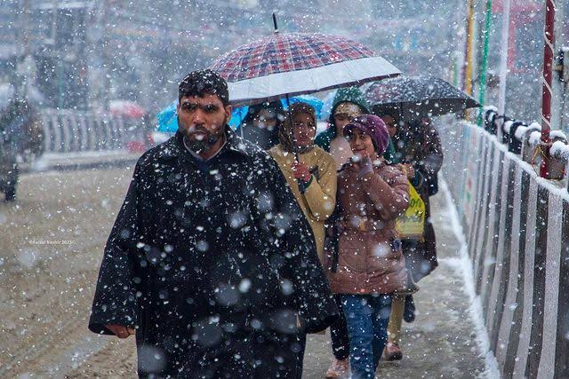
A strong Western Disturbance is going to affect Jammu and Kashmir between 18 & 20 February. Under its influence moderate to very heavy rain and snowfall is expected in most parts of the Union Territory.
Initially, there will be only rain in plains, which may transform into snowfall on 18th evening or on 19th Feb (for some plains only). The maximum chances of snowfall are in north Kashmir.
For central and south Kashmir plains it seems that rains will dominate. However, a continuous heavy spell of rain has always the potential of transforming into snowfall due to evaporational cooling. So, early snowfall can’t be ruled out completely.
Predicting an exact amount of snowfall is uncertain for any place. However, here are the chances of snowfall for North Kashmir: 65% (snow can occur in the evening of 18th or the next day).
Central Kashmir: 40% (snow can occur on 18th evening or 19th provided heavy spell of rain continues, same scenario applicable for 20th).
South Kashmir: 50% (snow can occur on 18th evening or 19th provided heavy spell of rain continues, same scenario applicable for 20th).
Snowfall that will occur will be higher in density & its accumulation has the potential of causing damage.
In upper reaches of north Kashmir, three day snow accumulation can range from 2 – 7 ft.
For central and south Kmr higher reaches, snow accumulation can range from 1 to 5 ft.
Shooting stones & Landslides are very likely to occur along Jammu-Srinagar National Highway. Disruptions can be there. So it is advisable to postpone your journey between 18 – 21st Feb.
𝙒𝙚𝙖𝙩𝙝𝙚𝙧 𝙐𝙥𝙙𝙖𝙩𝙚 𝙅&𝙆:17.02.24
𝙁𝙤𝙧𝙚𝙘𝙖𝙨𝙩
●Kashmir Division
●17th Feb:Generally cloudy with possibility of Light Snow at isolated higher reaches towards late night.
●18th Feb: Possibility of light to moderate Rain/Snow at most places with heavy snowfall over isolated higher reaches of North, Northwestern, Central and South Kashmir.
●19-20th Feb:Possibility of light to moderate Rain/Snow at most places (Plains & Lower reaches) with possibility of heavy to very heavy snowfall over middle & higher reaches of Kupwara, Baramulla, Bandipora, Ganderbal, Badgam & dists. of South Kashmir.
● 21st Feb:Possibility of intermittent Light to moderate Snow at many places till afternoon/late afternoon and gradual improvement thereafter.
●Jammu Division
●18th Feb: Possibility of Light to moderate Rain/Snow (over higher recahes) with thunder/Lightning at many places.
●19th-20th Feb: Possibility of intermittent light to moderate Rain with thunder/Lightning in plains of Jammu Division with light to moderate snowfall over higher reaches with heavy snowfall over isolated higher reaches of Ramban, Poonch, Doda and Kishtwar.
●21st Feb: Intermittent light to moderate Snow/Rain over many places till late afternoon/evening and gradual improvement thereafter.
𝘼𝘿𝙑𝙄𝙎𝙊𝙍𝙔 ⚠
1. The system may Lead to temporary closure of roads of higher reaches and important passes like Sinthan pass, Mughal Road, Sadhna & Razdan pass, Zojila etc.
2. Travellers are advised to Plan accordingly.
3. Farmers are advised to withheld irrigation and fertilizer application & drain out excess water from Orchards and fields during the above period.
4. Significant drop in day temperature during the above period is expected.
𝙈𝙀𝙏 𝘾𝙀𝙉𝙏𝙍𝙀 𝙎𝙍𝙄𝙉𝘼𝙂𝘼𝙍